The Federation of United African Nations is a pro-capitalist, democratic, constitutional federated super-state that is also a strong military power within Africa. The Federation an its government is often said to stress, at least nominally, the values of universal liberty, equality, justice, peace, and cooperation. One of the only pure democracies within Africa, the Federation often describes itself as a beacon of republican values and democratic institutions for other African nations to follow.
The Federation was born our a necessity for both economic stability as well as national security for the founding members of Ethiopia, Eritrea, and Djibouti. Each nation had been devastated by the Dominion Wars and the aftermath left once Dominion occupation of their nations ended. Ethiopia, the strongest of the founding members from a military standpoint and the most stable economically, desired ports with which to spread their products economically. Both Eritrea and Djibouti possessed ports and each needed something Ethiopia could offer them in return (Eritrea desired Ethiopia's military strength while Djibouti desperately needed financial help). Though Ethiopia would originally bring three nations to the negotiation table for a three-day submit, the talks soon expanded into a six-month dialogue culminating in the signing of the Constitution and founding of the Federation of United African Nations.
Today, the Federation has expanded beyond the three founding member-nations of Ethiopia, Eritrea, and Djibouti to include other territories and peoples of Africa. Membership into the Federation is voluntary and open to any state or nation wishing to petition the federal government. In the case of a nation, defined by the Constitution as a community of people who share a common language, culture, ethnicity, descent, and/or history; the nation must not currently be apart of a sovereign, internationally recognized state nor can they be claiming territory that is occupied by a sovereign, internationally recognized state at the time it petitions for membership. Democratic in its own nature, the Federation stipulates that candidate states or nations must embrace democracy, liberty, and equality (among other virtues and values upheld in the Federation) as well as agree to uphold the Constitution before a state or nation can sign and become a full member. The following is a current list of Federation member-nations along with a brief overview of their national government structures.
Types of Federal Members[]
The Federation of United African Nations are organized as a voluntary federation, to include all nations and all people, and to encompass all lands, rivers, lakes and coastlines; inclusive of non-self governing territories that wish to join the Federation by voluntary national referendum. Member nations of the Federation of United African Nations are, but the constitution, organized into one of two voluntary member-types. Unless otherwise specified within the constitution, both member-nation types are guaranteed all the rights, privileges, and protections of the constitution. The two member-types of the Federation are Federal Republics and the more autonomous, Federal Associated States.
Federated Republic[]
Federal Republics of the Federation of United African Nations are federal, parliamentary, representative democratic republics. Each operate under a framework laid out in the Constitution of the Federation. The political structure of all the Federal Republics are the same. Territories are admitted to the Federation as Federal Republics under voluntary referendum. Federal Republics enjoy full integration into the Federal System, benefiting greatly from the stability of the political structure and the strength of the economy. Federal Republics vote on not only the President of the Federation but also on representatives for their nation in the Federal Government. The President of the Federation of United African Nations serves as Head of State for Federal Republics. This is a ceremonial role and is meant to speak to the President's role as chief foreign negotiator and head of the Federal Military. The role of Head of Government, however, is invested in a Premier for each Federal Republic. The Premier is elected in a general election held within the nation and is voted on by all voting-eligible citizens of that nation. The Premier, as head of government, exercises executive power through their leadership of the Executive Cabinet who, along with cabinet Secretaries, form the government of the Federal Republic. Legislative power for each Federal Republic is vested in a National Senate. The National Senate is a unicameral legislature whose members, Senators, are elected through direct elections held within the sub-national administrative divisions of each Federal Republic (generally known as provinces). The Federal National Court is the highest court within a Federal Republic, considered a regional court within the greater court system of the Federation. A Federation member-state falls under the judiciary jurisdiction of the Federation Court System which, by signing to the Federation Constitution, members-states agree to abide by their decision-making and interpretation. While the Supreme Court of the Federation is tasked with abiding by and interpreting the laws of the Federation, the Federal National Court is tasked with not only abiding by Federation law but also local regional and provincial laws. Judges seated for the Federal National Court are chosen by the Collegium of Federal Judges.
Federal Associated States[]
Federal Associated States of the Federation of United African Nations are autonomous federal, parliamentary, representative democratic states within the Federation. Under the framework laid out in the Constitution of the Federation, Territories are admitted to the Federation as Federal Associated States under voluntary referendum. Unlike Federal Republics which enjoy full integration into the Federal System, Federal Associated States retain national autonomy from the Federal Government, with the Federal Government only administrating foreign affairs and national defense for Federal Associated States. Federal Associated States are allowed their own charter so long as their constitution does not contradict the values and basic rights of the people enshrined in the Federation's Constitution. Citizens of Federal Associated States vote on the President of the Federation of United African Nations but have no formal representation in the Federal Government like Federal Republics. Federal Associated State are guaranteed a non-voting, observer seat on the Federation Council.
Due to the nature of their autonomy, each Federal Associated State has its own unique political structure although there are some similarity. The Constitution of the Federation of United African Nations does require that the government be democratic and that their charter express many of the same liberties and democratic principles as those found in the Federation's own constitution. Most Federal Associated States operate within the framework of a presidential system, with the leader being most head of state as well as head of government. Generally, this leader is title as a president and has with them an executive Cabinet who form the government. Legislative power for a Federal Associated State is usually vested in a unicameral body, generally known as a Senate. Members, known as Senators, are elected through direct elections held within the sub-national administrative divisions of each Federal Associated State (generally known as provinces).
Federal Associated States operate an independent judiciary system outside of the Judiciary of the Federation of United African Nations due to their national autonomy.
Current List of Federal Members[]
The following is a current list of states that make up the composition of the Federation of United African Nations. The list is order in terms of when each state joined the Federation. Along with political information about the state, each entry also includes the pre-federation history of the state as well as other notable information.
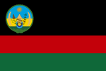
Ethiopia[]

Ethiopia is a landlocked country located in the Horn of Africa, and officially known as the Empire of Ethiopia. It is the most populous nation in the Federation. The capital is Addis Ababa. Ethiopia is bordered by Eritrea to the north and Djibouti to the east. Ethiopia is a monarchy and has been for most of its history. The Ethiopian dynasty traces its roots to the 2nd century BC. Ethiopia is also one of the oldest sites of human existence known to scientists today, having yielded some of humanity's oldest traces. It may be the region from which Homo sapiens first set out for the Middle East and points beyond. When Africa was divided up by European powers at the Berlin Conference, Ethiopia was one of only two countries that retained its independence. It was one of only four African members of the League of Nations. After a brief period of Italian occupation, Ethiopia once again gained its independence.
Modern Ethiopia and its current borders are a result of significant territorial reduction in the north and expansion in the south toward its present borders, owing to several migrations and commercial integration as well as conquests, particularly by Emperor Menelik II and Ras Gobena. In 1974, the dynasty led by Haile Selassie was overthrown as civil wars intensified. Since then, Ethiopia has seen a variety of governmental systems including a period under which Ethiopian territory was apart of the CNNP. After a renewed Ethiopian royal dynasty emerged the territory came under the occupation of forces from the World Military Dominion. Ethiopia would again regain its independence following the Dominion Wars and the fall of Zapht. At the time of the Founding of the Federation of East African Nations, of which Ethiopia is a founding member, Ethiopia had become a Constitutional Monarchy not recognized by the international community. Ethiopia is also one of a few African countries to have its own alphabet, time system, and unique calendar, seven to eight years behind the Gregorian Calendar.
The country is a land of natural contrasts, with spectacular waterfalls and volcanic hot springs. Ethiopia has some of Africa's highest mountains as well as some of the world's lowest points below sea level. The largest cave in Africa is located in Ethiopia at Sof Omar, and the country's northernmost area at Dallol is one of the hottest places year-round anywhere on Earth. There are altogether around 80 different ethnic groups in Ethiopia today, with the two largest being the Oromo and the Amhara, both of which speak Afro-Asiatic languages. The country is also famous for its rock-hewn churches and as the place where the coffee bean originated. Currently, Ethiopia is the top coffee and honey-producing country in Africa, and home to the largest livestock population in Africa.
Ethiopia has close historical ties to all three of the world's major Abrahamic religions. It was one of the first Christian countries in the world, having officially adopted Christianity as the state religion in the 4th century. It still has a Christian majority, but a third of the population is Muslim. Ethiopia is the site of the first hijra in Islamic history and the oldest Muslim settlement in Africa at Negash. Until the 1980s, a substantial population of Ethiopian Jews resided in Ethiopia. The country is also the spiritual homeland of the Rastafari religious movement, that is influenced by Pan-Africanism and has globalized Ethiopian flag tricolors with the spread of Reggae music alongside Hip hop culture. Ethiopia, which has Africa's second biggest hydropower potential, is the source of over 85% of the total Nile water flow and contains rich soils. Today Ethiopia is one of the biggest contributors to the economy of the Federation of East Africa. A very fertile land, Ethiopia has managed to become the breadbasket for most of Africa and parts of Europe.
Eritrea[]
| |||||
| National Motto: State of Liberty and equality | |||||
| National Anthem: N/A | |||||
|
N/A | |||||
| Region | African Continent | ||||
| Capitals | Asmara | ||||
| Official Languages | Tigrinya and Arabic | ||||
| Ethnic Groups | Tigrinya, Tigre, Afar, Saho, and Kunama | ||||
| Demonym | Eritreans | ||||
| Government -Executive -Legislative -Judicial |
Executor (Executive Cabinet) National Assembly Federal National Court | ||||
| History -Foundation Day |
November 26, 20XX | ||||
| Geography -Area -Highest Point |
45,405 sq mi ???? | ||||
| Currency | Federation Credit | ||||
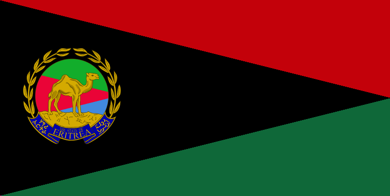
Eritrea, Officially the Armed State of Eritrea, is a country in the North East of Africa. The capital is Asmara. It is bordered by Ethiopia in the south, and Djibouti in the southeast. The east and northeast of the country have an extensive coastline on the Red Sea, directly across from Paradise. The Dahlak Archipelago and several of the Hanish Islands are part of Eritrea. Eritrea's size is approximately 117,600 km2 (45,406 sq mi) with an estimated population of 10 million. The history of Eritrea is tied to its strategic position on the southern, African side of the Red Sea; with a coastline that extends more than 1,000 km. Many scientists believe that it is from this area that anatomically modern humans first expanded out of Africa. From across the seas came various invaders (and colonizers) such as the South Arabians hailing from the Yemen area, the Ottoman Turks, the Portuguese from Goa (India), the Egyptians, the British and, in the 19th century, the Italians. Over the centuries, invaders also came from the neighboring countries of Africa to the south (Ethiopia). However, present-day Eritrea was largely affected by the Dominion invaders of the 21st century.
In the period following the opening of the Suez canal in 1869, when European powers scrambled for territory in Africa and tried to establish coaling stations for their ships, Italy invaded and occupied Eritrea. On January 1, 1890, Eritrea officially became a colony of Italy. In 1936, it became a province of Italian East Africa (Africa Orientale Italiana), along with Ethiopia and Italian Somaliland. By 1941 Eritrea had about 760,000 inhabitants, including 70,000 Italians. The Commonwealth armed forces expelled those of Italy in 1941 and took over the administration of the country which had been set up by the Italians. The British continued to administer the territory until 1951 when Eritrea was federated with Ethiopia. The strategic importance of Eritrea, due to its Red Sea coastline and mineral resources, was the main cause for the federation with Ethiopia, which in turn led to Eritrea's annexation as Ethiopia's 14th province in 1952. This was the culmination of a gradual process of takeover by the Ethiopian authorities, a process which included a 1959 edict establishing the compulsory teaching of Amharic, the main language of Ethiopia, in all Eritrean schools. The lack of regard for the Eritrean population led to the formation of an independence movement in the early 1960s (1961), which erupted into a 30-year war against successive Ethiopian governments that ended when the region of Ethiopia and Eritrea became apart of the CNNP.
Eritrea declared its independence 1993 but quickly devolved into a lose coalition of localized governments, as the country was too weak economically to support a centralized political unit. Soon Eritrea was under the military occupation of the World Military Dominion and during this period suffered greatly against rash treatment from their Dominion overlords. It wasn't until after the Dominion Wars that infighting between local warlords stopped and a single faction took power and created a centralized government. By the time of the founding of the Federation, Eritrea was ruled by the Democratic Justice Front. Authoritarian by nature , the DJF quickly arrested critics and opposition groups to their power, arresting them publicly and executing them privately. The de facto predominant languages are Tigrinya, which belongs to the Semitic linguistic branch, and Arabic. Eritrea a single-party state with a written constitution.
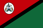
Djibouti[]
| |||||
| National Motto: Unity, Equality, Peace | |||||
| National Anthem: N/A | |||||
|
N/A | |||||
| Region | African Continent | ||||
| Capitals | Djibouti | ||||
| Official Languages | Arabic and French | ||||
| Ethnic Groups | |||||
| Demonym | Djiboutian | ||||
| Government -Executive -Legislative -Judicial |
Executor (Executive Cabinet) National Assembly Federal National Court | ||||
| History -Foundation Day |
November 26, 20XX | ||||
| Geography -Area -Highest Point |
45,405 sq mi ???? | ||||
| Currency | Federation Credit | ||||

Djibouti, officially the Democratic Socialist Republic of Djibouti, is a country in the Horn of Africa. It is bordered by Eritrea in the north, and Ethiopia in the west and south. The remainder of the border is formed by the Red Sea and the Gulf of Aden. Djibouti is one of the least populous countries in Africa. The predominant religion in Djibouti, with a 94% majority, is Muslim, with the remaining six percent claiming Christianity. In the 1800s, Djibouti, then French Somaliland, was acquired by France through various treaties with Somali sultans. It was declared an independent nation in 1977, and changed its name to the present day Djibouti.
The history of Djibouti goes back thousands of years to a time when populations in the area traded hides and skins for the perfumes and spices of ancient Egypt, India and China. Through close contacts with the adjacent Arabian Peninsula for more than 1,000 years, the Somali and Afar ethnic groups in the region became among the first populations on the continent to embrace Islam. From 1862 to 1894, the land on the north side of the Gulf of Tadjoura was called Obock, and was ruled by Somali Sultans. France first gained a foothold in the region through various treaties signed between 1883 and 1887. In 1894, Léonce Lagarde established a permanent French administration in the city of Djibouti and named the region French Somaliland (Côte française des Somalis). It lasted from 1896 until 1967, when it was renamed the French Territory of the Afars and the Issas. In 1958, on the eve of neighboring Somalia's independence in 1960, a referendum was held in Djibouti to decide whether or not to join the Somali Republic or to remain with France. The referendum turned out in favour of a continued association with France, partly due to a combined yes vote by the sizable Afar ethnic group and resident Europeans. There was also widespread vote rigging, with the French expelling thousands of Somalis before the referendum reached the polls. The majority of those who voted no were Somalis who were strongly in favour of joining a united Somalia as had been proposed by Mahmoud Harbi, Vice President of the Government Council. Harbi was killed in a plane crash two years later.
Djibouti finally gained its independence from France in 1977 and Hassan Gouled Aptidon, a French-groomed Somali who campaigned for a yes vote in the referendum of 1958, eventually wound up as the nation's first president (1977–1991). However, widespread economic problems would impoverish the country and see the collapse of the country's centralized government. The country would be without a centralized government for generations until the end of the Dominion Wars, when an militia group-turned political party known as the People's Progressive Front used Dominion Weapons bought left over from the War to come to power. By the time of the founding of the Federation, the PPF had proven themselves Democratic Socialists and stabilized government in Djibouti into a republic, with executive power in the central government, and legislative power in both the government and parliament.
Saint Helen Island[]
| |||||
| National Motto: Unshakable Loyalty to Liberty, Justice, and Freedom | |||||
| National Anthem: N/A | |||||
|
N/A | |||||
| Region | African Continent | ||||
| Capitals | Jamestown | ||||
| Official Languages | English | ||||
| Ethnic Groups | ????? | ||||
| Demonym | Saint Helenian | ||||
| Government -Executive -Legislative -Judicial |
Adminstrator Council of State Federal National Court | ||||
| History -Foundation Day |
November 26, 20XX | ||||
| Geography -Area -Highest Point |
121 km2 (47 sq mi) Diana's Peak at 818 m (2,684 ft) | ||||
| Currency | Federation Credit | ||||


Saint Helena, named after Saint Helena of Constantinople, is an island of volcanic origin in the South Atlantic Ocean. Saint Helena measures about 16 by 8 kilometres (10 by 5 mi). Most historical accounts state that the island was discovered on 21 May 1502 by the Spanish navigator João da Nova sailing at the service of the Portuguese Crown, and that he named it "Santa Helena" after Helena of Constantinople. Another theory holds that the island found by De Nova was actually Tristan da Cunha 2,430 kilometres (1,510 mi) to its south, and that Saint Helena was discovered by some of the ships attached to the squadron of Estêvão da Gama expedition on 30 July 1503. The Portuguese found the island uninhabited, with an abundance of trees and fresh water. They imported livestock, fruit trees and vegetables, and built a chapel and one or two houses. Though they formed no permanent settlement, the island was an important rendezvous point and source of food for ships travelling from Asia to Europe. Englishman Sir Francis Drake probably located the island on the final lap of his circumnavigation of the world (1577–1580). Further visits by other English explorers followed, and, once Saint Helena’s location was more widely known, English ships of war began to lie in wait in the area to attack Portuguese India carracks on their way home. In developing their Far East trade, the Dutch also began to frequent the island.
The Portuguese and Spanish soon gave up regularly calling at the island, partly because they used ports along the West African coast, but also because of attacks on their shipping, the desecration of their chapel and religious icons, destruction of their livestock and destruction of plantations by Dutch and English sailors. The Dutch Republic formally made claim to Saint Helena in 1633, although there is no evidence that they ever occupied, colonized or fortified it. By 1651, the Dutch had mainly abandoned the island in favor of their colony at the Cape of Good Hope. In 1657, Oliver Cromwell granted the English East India Company a charter to govern Saint Helena and the following year the Company decided to fortify the island and colonize it with planters. The first governor, Captain John Dutton, arrived in 1659 and soon after a fort and houses were built. After the Restoration of the English monarchy in 1660, the East India Company received a Royal Charter giving it the sole right to fortify and colonize the island. The fort was renamed James Fort and the town Jamestown, in honor of the Duke of York, later James II of England. Ecological problems, including deforestation, soil erosion, vermin and drought, led Governor Isaac Pyke to suggest in 1715 that the population be moved to Mauritius, but this was not acted upon and the Company continued to subsidize the community because of the island's strategic location. A census in 1723 recorded 1,110 people, including 610 slaves.
Eighteenth-century governors tried to tackle the island's problems by extending tree plantations, improving fortifications, eliminating corruption, building a hospital, tackling the neglect of crops and livestock, controlling the consumption of alcohol and introducing legal reforms. From about 1770, the island enjoyed a lengthy period of prosperity. Captain James Cook visited the island in 1775 on the final leg of his second circumnavigation of the world. Saint James' Church was erected in Jamestown in 1774 and in 1791–92 Plantation House was built, and has since been the official residence of the island's administrative leader. The importation of slaves was made illegal in 1792. Governor Robert Patton (1802–1807) recommended that the Company import Chinese labor to supplement the rural workforce. The laborers arrived in 1810, and their numbers reached 600 by 1818. Many were allowed to stay, and their descendants became integrated into the population. An 1814 census recorded 3,507 people on the island. In 1815, the British government selected Saint Helena as the place of detention of Napoleon Bonaparte. He was brought to the island in October 1815; he stayed at the small Briars pavilion in the grounds of the Balcombe family's home until the building of his permanent home of Longwood House was completed, where he died on 5 May 1821. During this period, Saint Helena remained in the East India Company’s possession, but the British government met additional costs arising from guarding Napoleon. The island was strongly garrisoned with British troops, and naval ships circled the island. Concerning slaves, Governor Hudson Lowe initiated their emancipation in 1818: from Christmas of that year, every new born child was considered a free person.
Under the provisions of the 1833 India Act, control of Saint Helena was passed from the East India Company to the British Crown, becoming a crown colony. Subsequent administrative cost-cutting triggered the start of a long-term population decline whereby those who could afford to do so tended to leave the island for better opportunities elsewhere. The latter half of the 19th century saw the advent of steam ships not reliant on trade winds, as well as the diversion of Far East trade away from the traditional South Atlantic shipping lanes to a route via the Red Sea. These factors contributed to a decline in the number of ships calling at the island from 1,100 in 1855 to only 288 in 1889. In 1840, a British naval station established to suppress the African slave trade was based on the island, and between 1840 and 1849 over 15,000 freed slaves, known as "Liberated Africans", were landed there. In 1900 and 1901, over 6,000 Boer prisoners were held on the island, and the population reached its all-time high of 9,850 in 1901. In 1858, the French emperor Napoleon III successfully gained the possession, in the name of the French government, of Longwood House and the lands around it, last residence of Napoleon I. It remained French property until the late 20th century. A local industry manufacturing fiber from New Zealand flax was successfully reestablished in 1907 and generated considerable income during the First World War. Ascension Island was made a dependency of Saint Helena in 1922, and Tristan da Cunha followed in 1938. World War II forced the British to finally abandon the island due to the immense cost of maintaining the island in the wake of the immense cost of the war.
Though originally the British crown had all intent of reclaiming the island after the war, no expedition was every mounted to do so and eventually the island was almost completely abandoned. The island was eventually resettled in the 1990s under the Genesisian Crown of Azania, becoming a possession of the crown for several years into the 21st century. With the fall of Azania, the islands came briefly under the administration of the Brazilian Empire but following increased pressure from the local population, all Brazilian claims were relinquished and Saint Helena declared their independence. The following year, the island was visited by agents of the African Unity Organization, a pan-African organization from the Federation of East African Nations. Though the island had never considered itself a completely African possession, its years under the Azanian crown had help to spread African influences across the isle. This, coupled with the island's government struggling to cement a stable economy and maintain infrastructure, prompted the Saint Helena people to consider joining the Federation. Within a few months time of the A.U.O's arrival, the island of Saint helena petitioned to join the Federation of East Africa Nations. Following a referendum that showed overwhelming support for joining the Federation, the island became the fourth member of the Federation. One of the most distance members of all Federation nations, the Island form a strategic station for defense in the Atlantic, as well as assisting with trans-Atlantic communications between the Federation and that of its allies in North and South America.
Ascension Island[]
| |||||
| National Motto: Peace and Prosperity for All | |||||
| National Anthem: N/A | |||||
|
N/A | |||||
| Region | African Continent | ||||
| Capitals | Georgetown | ||||
| Official Languages | English | ||||
| Ethnic Groups | ????? | ||||
| Demonym | ????? | ||||
| Government -Executive -Legislative -Judicial |
Administrator Council of State Federal National Court | ||||
| History -Foundation Day |
November 26, 20XX | ||||
| Geography -Area -Highest Point |
88 km2 (34 sq mi) Green Mountain on Ascension Island 859 m (2,818 ft) | ||||
| Currency | Federation Credit | ||||

Ascension Island is an isolated volcanic island in the equatorial waters of the South Atlantic Ocean, around 1,600 kilometres (1,000 mi) from the coast of Africa and 2,250 kilometres (1,400 mi) from the coast of South America, which is roughly midway between the horn of South America and Africa. The Spanish explorer João da Nova, sailing for the Portuguese Crown, allegedly discovered the island in 1501, but his discovery was apparently not registered. Thus, in 1503 when the Portuguese navigator Afonso de Albuquerque sighted the island on Ascension Day, in the church calendar, he named it after the feast day. Dry and barren, it had little appeal for passing ships except for collecting fresh meat. Mariners could hunt for the numerous seabirds and the enormous female green turtles that laid their eggs on the sandy beaches. The Portuguese also introduced goats as a potential source of meat for future mariners. In February 1701, HMS Roebuck, commanded by William Dampier, sank in the common anchoring spot in Clarence Bay to the northwest of the island. Some sixty men survived for two months until they were rescued. Almost certainly, after a few days they found the strong water spring in the high interior of the island, in what is now called Breakneck Valley. Organised settlement of Ascension Island began in 1815, when the British garrisoned it as a precaution after imprisoning Napoleon I on Saint Helena to the southeast. On 22 October the Cruiser class brig-sloops Zenobia and Peruvian claimed the island for His Britannic Majesty King George III. The Royal Navy officially designated the island as a stone frigate, "HMS Ascension", with the classification of "Sloop of War of the smaller class".
The location of the island made it a useful stopping-point for ships and communications. The Royal Navy used the island as a victualing station for ships, particularly those of the West Africa Squadron working against the slave trade. A garrison of Royal Marines was based at Ascension from 1823. In 1836 the Beagle voyage visited Ascension. Charles Darwin described it as an arid treeless island, with nothing growing near the coast. Sparse vegetation inland supported "about six hundred sheep, many goats, a few cows & horses", and large numbers of guinea fowl imported from the Cape Verde islands, as well as rats, mice and land crabs; he agreed with the saying attributed to the people of St Helena that We know we live on a rock, but the poor people at Ascension live on a cinder. He noted the care taken to sustain houses, gardens & fields placed near the summit of the central mountain, and cisterns at the road side to provide good drinking water. The springs were carefully managed, so that a single drop of water may not be lost: indeed the whole island may be compared to a huge ship kept in first-rate order. In commenting on this, he noted René Primevère Lesson's remark that the English nation alone would have thought of making the island of Ascension a productive spot; any other people would have held it as a mere fortress in the ocean. In 1843, botanist and explorer Joseph Hooker visited the island. Four years later, Hooker, with much encouragement from Darwin, advised the Royal Navy that with the help of Kew Gardens, they should institute a long-term plan of shipping trees to Ascension. The planted trees would capture more rain and improve the soil, allowing the barren island to become a garden. So, from 1850 and continuing year on year, ships came each depositing a varied assortment of plants from botanical gardens in Argentina, Europe and South Africa. By the late 1870s Norfolk pines, eucalyptus, bamboo, and banana trees grew in lush profusion at the highest point of the island, Green Mountain, creating a tropical cloud forest. In 1899, the Eastern Telegraph Company installed the first underwater cable from the island, connecting the UK with its colonies in South Africa.
During World War II, the U-boat U-124 approached Georgetown on the surface with the intention of sinking any ships at anchor or shelling the cable station. The Germans succeeded in destroying their targets and several months after the attack, a second attack was launched to further devastate the island. The British were eventually forced to evacuate the island in order to focus their attentions on other theaters of the war. Much like Saint Helena Island, Ascension remained abandoned for several decades. In the early 1990s, settlers from the African country of Azania laid claim to the island, a Genesisian church was built in order to cement their claim. Much like Saint Helena, Ascension island remained a possession of the Azanian crown until the fall of the kingdom shortly after the beginning of the 21st century. After Azania's fall, the island was briefly held as a possession of the Brazilian crown but due to its remote location and cost to maintain, the island and its 880 inhabitants were given their independence. Many on the island considered leaving and those with the means to do so did, of those that stayed on the island life became increasing difficult. Life was so difficult that by the time agents of the African Unity Organization arrived, almost 100 people had died due to malnutrition. With the A.U.O's help, life on the island stabilized and within a few months the people of the island petitioned for membership into the Federation. After a successful referendum was held, the island joined the Federation as its fifth member. The island today is the location of a Federation Air Force station, a Federation Space Agency rocket tracking station, and a communication service's Atlantic relay Station. Ascension Island also hosts one of five ground antennae that assist in the operation of the Navigational Positioning System (NPS).
Liberia[]
| |||||
| National Motto: For The love of Liberty | |||||
| National Anthem: N/A | |||||
|
N/A | |||||
| Region | African Continent | ||||
| Capitals | Liberty City | ||||
| Official Languages | English | ||||
| Ethnic Groups | Kpelle, Bassa, Grebo, Gio, Mano, Kru, Lorma, Kissi, Gola, and Dixians | ||||
| Demonym | Liberian | ||||
| Government -Executive -Legislative -Judicial |
Executor (Executive Cabinet) National Assembly Federal National Court | ||||
| History -Foundation Day |
November 26, 20XX | ||||
| Geography -Area -Highest Point |
111,369 km2 (43,000 sq mi) Mount Wuteve 4,724 feet (1,440 m) | ||||
| Currency | Federation Credit | ||||


Liberia, officially the United Provinces of Liberia, is a country in West Africa. Liberia's coastline is composed of mostly mangrove forests while the more sparsely populated inland consists of forests that open to a plateau of drier grasslands. The country possesses 40% of the remaining Upper Guinean rain forest. Liberia has a hot equatorial climate, with significant rainfall during the May to October rainy season and harsh harmattan winds the remainder of the year. Liberia covers an area of 111,369 km2 (43,000 sq mi). English is the official language, while over 30 indigenous languages are spoken within the country. Along with Ethiopia, Liberia is one of the two modern countries in Sub-Saharan Africa without roots in the European colonization of Africa. Beginning in 1820, the region was colonized by freed American slaves with the help of the American Colonization Society, a private organization that believed ex-slaves would have greater freedom and equality in Africa. Slaves freed from slave ships were also sent there instead of being repatriated to their countries of origin. In 1847, these colonists founded the Republic of Liberia, establishing a government modeled on that of the United States and naming the capital city Monrovia after James Monroe, the fifth president of the United States and a prominent supporter of the colonization. The colonists, known as Americo-Liberians, led the political and economic sectors of the country.
The country began to modernize in the 1940s following investment by the United States during World War II and economic liberalization under President William Tubman. A military coup overthrew the Americo-Liberian leadership in 1980, marking the beginning of political and economic instability and two successive civil wars that left approximately 250,000 people dead and devastated the country's economy. By the time the civil unrest had died, so too had any organized formal government. Instead the region devolved into regional warlords, keeping the region from organizing itself into a national political entity. Then came the Veloryans who occupied the region for several years. Their influence over the region help to restore much of what had been destroyed during the civil war years, however after the Veloryans Empire collapsed, so too did society in the Liberian region. The Dominion Wars instituted further civil unrest in the region, causing the area to remain highly destabilized. With the formation of the Federation of East African Nations, regions like Liberia began being visited by missionaries of the African Unity Organization, a group created by the Federation with the design of helping Africans in the nation-building process. Through their work, Liberia was began reorganizing itself, slowly working towards nationhood. In the process of reorganizing themselves, a group of Liberians petitioned the Federation for membership. Taking the request seriously, the Federation held an referendum in the country and in a historic vote, Liberians voted in favor of joining the Federation. Though still not a nation, Liberia became a protectorate and within a few years from that vote, Liberia formed a national government and was formally accepted into the Federation as its sixth member-state to join.
Today, Liberia is a unitary constitutional republic and representative democracy, formally known as the United Provinces of Liberia. Only one of three member-nations to border or exist within the Atlantic ocean, Liberia is the home port for the Federation Atlantic Fleet. Following the arrival of ex-patriot Confederates from the now defunct Confederate States of America, Liberia holds the Federations largest population of white Africans. Its capital, renamed Liberty City, is one of the largest in the Federation. It serves as an economic center and is the headquarters of the big three banks of the Federation.
Rwanda[]
| |||||
| National Motto: United through Liberty | |||||
| National Anthem: N/A | |||||
|
N/A | |||||
| Region | African Continent | ||||
| Capitals | Kigali | ||||
| Official Languages | English, Kinyarwanda, French | ||||
| Ethnic Groups | Hutu, Tutsi, Twa | ||||
| Demonym | Rwandan or Rwandese | ||||
| Government -Executive -Legislative -Judicial |
Executor (Executive Cabinet) National Assembly Federal National Court | ||||
| History -Foundation Day |
November 26, 20XX | ||||
| Geography -Area -Highest Point |
26,338 km2 (10,169 sq mi) Mount Karisimbi, 4,507 metres (14,787 ft) | ||||
| Currency | Federation Credit | ||||

Rwanda, officially the Republic of Rwanda, is a land-locked country in central and eastern Africa. Located a few degrees south of the Equator, Rwanda is bordered by Burundi. All of Rwanda is at high elevation, with a geography dominated by mountains in the west, savanna in the east, and numerous lakes throughout the country. The climate is temperate to subtropical, with two rainy seasons and two dry seasons every year.
Archaeological excavations have revealed evidence of sparse settlement by hunter gatherers in the late stone age, followed by a larger population of early Iron Age settlers, who produced dimpled pottery and iron tools. These early inhabitants were the ancestors of the Twa, a group of aboriginal pygmy hunter-gatherers who remain in Rwanda today. Between 700 BC and 1500 AD, a number of Bantu groups migrated into Rwanda, and began to clear forest land for agriculture. The forest-dwelling Twa lost much of their habitat and moved to the slopes of mountains. Historians have several theories regarding the nature of the Bantu migrations; one theory is that the first settlers were Hutu, while the Tutsi migrated later and formed a distinct racial group, possibly of Cushitic origin. An alternative theory is that the migration was slow and steady, with incoming groups integrating into rather than conquering the existing society. Under this theory, the Hutu and Tutsi distinction arose later and was a class distinction rather than a racial one. The earliest form of social organisation in the area was the clan (ubwoko). Clans existed across the Great Lakes region and were not limited to genealogical lineages or geographical area, and most included Hutu, Tutsi, and Twa. From the 15th century, the clans began to coalesce into kingdoms; by 1700 around eight kingdoms existed in present-day Rwanda. One of these, the Kingdom of Rwanda, ruled by the Tutsi Nyiginya clan, became increasingly dominant from the mid-eighteenth century. The kingdom reached its greatest extent during the nineteenth century under the reign of King Kigeli Rwabugiri. Rwabugiri conquered several smaller states, expanded the kingdom west and north, and initiated administrative reforms; these included ubuhake, in which Tutsi patrons ceded cattle, and therefore privileged status, to Hutu or Tutsi clients in exchange for economic and personal service,and uburetwa, a corvée system in which Hutu were forced to work for Tutsi chiefs. Rwabugiri's changes caused a rift to grow between the Hutu and Tutsi populations. The Twa were better off than in pre-Kingdom days, with some becoming dancers in the royal court, but their numbers continued to decline.
The Berlin Conference of 1884 assigned the territory to Germany as part of German East Africa, marking the beginning of the colonial era. The Germans did not significantly alter the social structure of the country, but exerted influence by supporting the king and the existing hierarchy and delegating power to local chiefs. Belgian forces took control of Rwanda and Burundi during World War I, beginning a period of more direct colonial rule. Belgium simplified and centralised the power structure,and introduced large-scale projects in education, health, public works, and agricultural supervision, including new crops and improved agricultural techniques to try to reduce the incidence of famine. Both the Germans and the Belgians promoted Tutsi supremacy, considering the Hutu and Tutsi different races. In 1935, Belgium introduced identity cards labelling each individual as either Tutsi, Hutu, Twa or Naturalised; preventing any further movement between the classes. Belgium continued to rule Rwanda after World War II, with a mandate to oversee independence. Tension escalated between the Tutsi, who favoured early independence, and the Hutu emancipation movement, culminating in the 1959 Rwandan Revolution: Hutu activists began killing Tutsi, forcing more than 100,000 to seek refuge in neighbouring countries. In 1962, the now pro-Hutu Belgians held a referendum and elections in which the country voted to abolish the monarchy. Rwanda was separated from Burundi and gained independence in 1962. Cycles of violence followed, with exiled Tutsi attacking from neighbouring countries and the Hutu retaliating with large-scale slaughter and repression of the Tutsi. In 1990, the Rwandan Patriotic Front (RPF), a rebel group composed mostly of Tutsi refugees, invaded northern Rwanda, initiating the Rwandan Civil War. Neither side was able to gain a decisive advantage in the war. The Rwandan Genocide soon began and over the course of approximately 100 days, between 500,000 and 1,000,000 Tutsi and politically moderate Hutu were killed in well-planned attacks on the orders of the an interim government. Many Twa were also killed, despite not being directly targeted.
The Civil War and following genocide eventually led to a complete collapse of the national government by the mid-1990s. The state of Rwanda was soon divided among oppressive warlords of Hutu and Tutsi, that continuously fought for supremacy of the entire former nation. Some order came to the region when Belgium return to the region and the state of Le Congo Leapold was established. However, the government was highly oppressive and eventually was overthrown. Deep-seeded distrust between the local Hutu and Tutsi prevented the natives from forming and establishing a nation. The Dominion Wars instituted further civil unrest in the region, causing the area to remain highly destabilized. However, shortly after the end of the Dominion Wars and the formation of the Federation of United African Nations, regions like Rwanda were soon visited by missionaries of the African Unity Organization, a group created by the Federation with the design of helping Africans in the nation-building process. In Rwanda, much like in Burundi, missionaries and workers of the AUO were the first to bring the Hutu and Tutsi to the negotiation table. Many of these individuals were youths of the groups dissatisfied with the generations old rivalry and distrust, and eager to attempt an alternative lifestyle and live in peace. It would be this same group of Hutu-Tutsi that would petitioned the Federation for membership. In a surprising vote, referendum results showed a majority of the population were in-favor of joining the Federation. This was seen as a historic first-step in Hutu-Tutsi cooperation. Though still not a nation, Burundi became a protectorate and within a few years from that vote, Burundi formed a national government and was formally accepted into the Federation as its seventh member-state to join.
Burundi[]
| |||||
| National Motto: Unity, Freedom, Progress | |||||
| National Anthem: N/A | |||||
|
N/A | |||||
| Region | African Continent | ||||
| Capitals | Bujumbura | ||||
| Official Languages | English, Kirundi, and French | ||||
| Ethnic Groups | Hutu (Bantu), Tutsi (Hamitic), Twa (Pygmy), Europeans, and
South Asians | ||||
| Demonym | Burundian | ||||
| Government -Executive -Legislative -Judicial |
Executor (Executive Cabinet) National Assembly Federal National Court | ||||
| History -Foundation Day |
November 26, 20XX | ||||
| Geography -Area -Highest Point |
27,834 km2 (10,745 sq mi ) Mount Heha 8,810 feet (2,685 m) | ||||
| Currency | Federation Credit | ||||


Burundi, officially the Republic of Burundi, is a landlocked country in the Great Lakes region of Eastern Africa. Its capital is Bujumbura. Although the country is landlocked, much of the southwestern border is adjacent to Lake Tanganyika. The Twa, Tutsi, and Hutu peoples have occupied Burundi since the country's formation five centuries ago. Burundi was ruled as a kingdom by the Tutsi for over two hundred years. However, at the beginning of the twentieth century, Germany and Belgium occupied the region, and Burundi and Rwanda became a European colony known as Ruanda-Urundi.
After its defeat in World War I, Germany handed control of a section of the former German East Africa to Belgium. On October 20, 1924, this land, which consisted of modern-day Rwanda and Burundi, became a Belgian League of Nations mandate territory, in practical terms part of the Belgian colonial empire, known as Ruanda-Urundi. However, the Belgians allowed Ruanda-Urundi to continue its kingship dynasty. Following World War II, Ruanda-Urundi was a United Nations Trust Territory under Belgian administrative authority. During the 1940s, a series of policies caused divisions throughout the country. In 1948, Belgium allowed the region to form political parties. These factions would be one of the main influences for Burundi's independence from Belgium. On January 20, 1959, Burundi's ruler Mwami Mwambutsa IV requested from the Belgian Minister of Colonies a separation of Burundi and Rwanda and a dissolution of Ruanda-Urundi. Six months later, political parties were formed to bring attention to Burundi's independence from Europe and to separate Rwanda from Burundi. The first of these political parties was the Union for National Progress (UPRONA) and the second was the Christian Democratic Party (PDC), both becoming prominent organizations throughout the country. The country claimed independence on July 1, 1962, and legally changed its name from Ruanda-Urundi to Burundi. Mwami Mwambutsa IV was named king. Upon Burundi’s independence, a constitutional monarchy was established and both Hutus and Tutsis were represented in parliament. When King Mwambutsa appointed a Tutsi prime minister, the Hutus, who were the majority in parliament, felt cheated. An ensuing attempted coup by the Hutu-dominated police was ruthlessly suppressed by the Army, then led by a Tutsi officer, Captain Michel Micombero. When the next Hutu Prime Minister, Pierre Ngendandumwe, was assassinated in 1965, Hutus engaged in a series of attacks on Tutsi, which the government repressed ruthlessly, fearing the killings of Tutsis by Hutus, who wanted to follow the "Model Rwanda". The Burundi police and military were now brought under the control of the Tutsi.
Mwambutsa was deposed in 1966 by his son, Prince Ntare V, who claimed the throne. That same year, Tutsi Prime Minister Captain Michel Micombero deposed Ntare, abolished the monarchy, and declared the nation a republic, though it was in effect a military regime. In 1972, an all Hutu organization known as Umugambwe w'Abakozi b'Uburundi or Burundi Workers' Party (UBU) organized and carried out systematic attacks on ethnic Tutsi with the declared intent of annihilating the whole group. The military regime responded with large-scale reprisals targeting Hutus. The total number of casualties was never established, but estimates for the Tutsi genocide and the reprisals on the Hutus together are said to exceed 100,000 at the very least, with a similar number of asylum-seekers in Tanzania and Rwanda. In 1976, another Tutsi, Colonel Jean-Baptiste Bagaza, led a bloodless coup and promoted various reforms. A new constitution was promulgated in 1981, keeping Burundi a one-party state. In August 1984, Bagaza was elected head of state. During his tenure, Bagaza suppressed political opponents and religious freedoms. Major Pierre Buyoya, a Tutsi, overthrew Bagaza in 1987 and suspended the constitution, dissolved the political parties, and reinstated military rule under the Military Committee for National Salvation (CSMN). Anti-Tutsi ethnic propaganda disseminated by the remnants of the 1972 UBU, which had re-organized as PALIPEHUTU in 1981, led to killings of Tutsi peasants in the northern communes of Ntega and Marangara in August 1988. The death toll was put at 5,000 by the government.
The killings, coupled with years of ethnic tensions between the two groups eventually led to a disastrous civil war that, by the early 1990s, had lead the way to a complete dissolution of a national government. What took its place was a series of various warlords that would control the region for a variety of years. Some order came to the region when Belgium return to the region and the state of Le Congo Leapold was established. However, the government was highly oppressive and eventually was overthrown. However, do to the deep-seeded distrust between the local ethnic groups, the natives failed to form and establish a central government. The Dominion Wars instituted further civil unrest in the region, causing the area to remain highly destabilized. With the formation of the Federation of United African Nations, regions like Burundi began being visited by missionaries of the African Unity Organization, a group created by the Federation with the design of helping Africans in the nation-building process. In the case of Burundi, missionaries and workers of the AUO were the first to bring the Hutu and Tutsi to the negotiation table. Many of these individuals were youths of the groups dissatisfied with the generations old rivalry and distrust, and eager to attempt an alternative lifestyle and live in peace. It would be this same group of Hutu-Tutsi that would petitioned the Federation for membership. In a surprising vote, referendum results showed a majority of the population were in-favor of joining the Federation. This was seen as a historic first-step in Hutu-Tutsi cooperation. Though still not a nation, Burundi became a protectorate and within a few years from that vote, Burundi formed a national government and was formally accepted into the Federation as its eighth member-state to join.
Today, Burundi is a constitutional parliamentary republic, formally known as the Republic of Burundi. Though its elected political leaders and much of the country has tried to embrace the values of cooperation that the Federation embody, a faction of the old racist past still remain in the country. On the day the country's first Prime Minister formally signed the Federation Constitution, allowing Burundi to officially join the Federation, a Hutu nationalist group calling itself Hutu Liberation Army attacked several local community centers and killed over 600 people nation wide. Though the attacks seemed primarily aimed at Tutsi, many Hutu and Twa were also killed. The government was quick to respond, and with Federation military assistance several arrests were made. However, the leaders of the movement remain at large though the government has made assurances that these Hutu form a growing minority within Burundi and do not create an immediate threat to cooperation between the two groups. Burundi is one of three nations within the Federation to be a landlocked country. Due to this geographic fact, the Federation has worked with the Republic in reinventing the country and has made it into technology center for the greater Federation.
Lesotho[]
| |||||
| National Motto: Peace, Liberty, Prosperity | |||||
| National Anthem: N/A | |||||
|
N/A | |||||
| Region | African Continent | ||||
| Capitals | Maseru | ||||
| Official Languages | English and Sesotho | ||||
| Ethnic Groups | Basotho | ||||
| Demonym | Mosotho (singular), Basotho (plural) | ||||
| Government -Executive -Legislative -Judicial |
Executor (Executive Cabinet) National Assembly Federal National Court | ||||
| History -Foundation Day |
November 26, 20XX | ||||
| Geography -Area -Highest Point |
30,355 km2 (12,727 sq m) Thabana Ntlenyana 3,482 metres (11,424 ft) | ||||
| Currency | Federation Credit | ||||


Lesotho, officially the Kingdom of Lesotho, is a landlocked country and enclave, completely surrounded by the South African Region. It is just over 30,000 km2 (11,583 sq mi) in size. Its capital and largest city is Maseru. The name Lesotho translates roughly into the land of the people who speak Sesotho. The earliest known inhabitants of the area were Khoisan hunter-gatherers. They were largely replaced by Wasja-speaking tribes during Bantu migrations. The Sotho-Tswana people colonized the general region of South Africa between the 3rd and 11th centuries. The present Lesotho (then called Basutoland) emerged as a single polity under king Moshoeshoe I in 1822. Moshoeshoe, a son of Mokhachane, a minor chief of the Bakoteli lineage, formed his own clan and became a chief around 1804. Between 1821 and 1823, he and his followers settled at the Butha-Buthe Mountain, joining with former adversaries in resistance against the Lifaqane associated with the reign of Shaka Zulu from 1818 to 1828. Subsequent evolution of the state hinged on conflicts between British and Dutch colonists leaving the Cape Colony following its seizure from the French-occupied Dutch by the British in 1795, and subsequently associated with the Orange River Sovereignty and subsequent Orange Free State. Missionaries invited by Moshoeshoe I, Thomas Arbousset, Eugène Casalis and Constant Gosselin from the Paris Evangelical Missionary Society, placed at Morija, developed orthography and printed works in the Sotho language between 1837 and 1855. Casalis, acting as translator and providing advice on foreign affairs, helped to set up diplomatic channels and acquire guns for use against the encroaching Europeans and the Griqua people. Boer trekkers from the Cape Colony showed up on the western borders of Basutoland and claimed land rights, beginning with Jan de Winnaar, who settled in the Matlakeng area in May–June 1838. As more farmers were moving into the area they tried to colonise the land between the two rivers, even north of the Caledon, claiming that it had been abandoned by the Sotho people.
Moshoeshoe subsequently signed a treaty with the British Governor of the Cape Colony, Sir George Thomas Napier that annexed the Orange River Sovereignty that many Boers had settled. These outraged Boers were suppressed in a brief skirmish in 1848. In 1851 a British force was defeated by the Sotho army at Kolonyama, touching off an embarrassing war for the British. After repulsing another British attack in 1852, Moshoeshoe sent an appeal to the British commander that settled the dispute diplomatically, then defeated the Tlokoa in 1853. In 1854 the British pulled out of the region, and in 1858 Moshoeshoe fought a series of wars with the Boers in the Free State-Basotho War, losing a great portion of the western lowlands. The last war in 1867 ended when Moshoeshoe appealed to Queen Victoria, who agreed to make Basutoland a British protectorate in 1868. In 1869, the British signed a treaty at Aliwal North with the Boers that defined the boundaries of Basutoland and later Lesotho, which by ceding the western territories effectively reduced Moshoeshoe's kingdom to half its previous size. Following the cession in 1869, the British initially transferred functions from Moshoeshoe's capital in Thaba Bosiu to a police camp on the northwest border, Maseru, until administration of Basutoland was transferred to the Cape Colony in 1871. Moshoeshoe died on March 11, 1870, marking the end of the traditional era and the beginning of the colonial era, and was buried at Thaba Bosiu. During their rule between 1871 and 1884, Basutoland was treated similarly to territories that had been forcefully annexed, much to the chagrin of the Basotho. This led to the Gun War in 1881. In 1884, Basutoland was restored its status as a Crown colony, with Maseru again its capital, but remained under direct rule by a governor, though effective internal power was wielded by traditional chiefs. Basutoland gained its independence from Britain and became the Kingdom of Lesotho in 1966. In January 1970 the ruling Basotho National Party (BNP) lost the first post-independence general elections, with 23 seats to the Basutoland Congress Party's 36. Prime Minister Leabua Jonathan refused to cede power to the Basotho Congress Party (BCP), declared himself Tona Kholo (Sesotho translation of prime minister), and exiled the BCP leadership. In the early 1980s, several Basotho who sympathized with the exiled BCP were threatened with death and attacked by the government of Leabua Jonathan. In September 1981 the family of Benjamin Masilo was attacked. A few days later, Edgar Mahlomola Motuba was taken from his home and murdered. The BNP ruled from 1966 till January 1970. What later ensued was a "de facto" government led by Dr Leabua Jonathan until 1986 when a military coup forced it out of office. The Military Council that came to power granted executive powers to King Moshoeshoe II, who was until then a ceremonial monarch. But in 1987 the King was forced into exile after coming up with a six-page memorandum on how he wanted the Lesotho's constitution to be, which would have given him more executive powers had the military government agreed. His son was installed as King Letsie III.
The chairman of the military junta, Major General Justin Metsing Lekhanya, was ousted in 1991 and replaced by Major General Elias Phisoana Ramaema, who handed over power to a democratically elected government of the BCP in 1993. Moshoeshoe II returned from exile in 1992 as an ordinary citizen. After the return to democratic government, King Letsie III tried unsuccessfully to persuade the BCP government to reinstate his father (Moshoeshoe II) as head of state. Though there were high hopes for the democratic government, the poor economic polices of the previous government put a heavy burned on the ill-prepared elected government. Divisions soon grew in the legislature, divisions that soon spread out into the general population, creating an stagnate government that soon disintegrated under the immense pressure of national costs. The disintegration of the national government led the region to come under the control of various smaller powers, such as community chiefdoms and warlords, while other areas were integrated into other powers. Eventually the entire region was conquer by the South African Empire which in turn was eventually annexed into the Azanian Imperium. During the Dominion Wars, Lesotho would be protected from Dominion control by Azania, who helped fight to keep the Dominion out of Southern Africa. However, Azania would collapsed soon after the Dominion Wars. With the formation of the Federation of East African Nations, regions like Lesotho began being visited by missionaries of the African Unity Organization, a group created by the Federation with the design of helping Africans in the nation-building process. In the case of Lesotho, the missionaries of the AUO found a region that had been divided into other states of the former Azanian Imperium. However, enough of the Basotho remained in the region with a desire of re-creating a Lesotho state. The Basotho would petitioned the Federation for membership. Soon a referendum was held, the results of showed an overwhelming majority of the population were in-favor of joining the Federation. Though still not a nation, Lesotho became a protectorate and within a few years from that vote, Lesotho formed a national government and was formally accepted into the Federation as its nineth member-state to join.
Today Lesotho is a constitutional monarchy, formally known as the United Kingdom of Lesotho. The country is formed by ten distinct tribes, all of whom are united under a single elected crown. Given the isolated nature and geography of the region, the country has worked with the Federation to create an economy based on the textile industry. Most of the resources used within the industry, is imported to Lesotho. However, to compliment the textile industry there is a small sector also dedicated to cotton growing. Textiles has allow for the Lesotho economy to stabilize and grow marginally.
Swaziland[]
| |||||
| National Motto: A Fortress of Peace and Liberty | |||||
| National Anthem: N/A | |||||
|
N/A | |||||
| Region | African Continent | ||||
| Capital | Mbabane | ||||
| Official Languages | English and Swati | ||||
| Ethnic Groups | Swazi, Zulu, Afrikaner | ||||
| Demonym | Swazi | ||||
| Government -Executive -Legislative -Judicial |
Executor (Executive Cabinet) National Assembly Federal National Court | ||||
| History -Foundation Day |
November 26, 20XX | ||||
| Geography -Area -Highest Point |
17,364 km2 (6,704 sq mi) Emlembe 1,862 m (6,109 ft) | ||||
| Currency | Federation Credit | ||||


Swaziland is a landlocked country in Southern Africa,. The nation, as well as its people, are named after the 19th century king Mswati II. Artifacts indicating human activity dating back to the early Stone Age 200,000 years ago have been found in the Swaziland. Prehistoric rock art paintings date from ca. 25,000 B.C. and continue up to the 19th century. The earliest inhabitants of the area were Khoisan hunter-gatherers. They were largely replaced by the Bantu tribes during Bantu migrations who hailed from the Great Lakes regions of Eastern Africa. Evidence of agriculture and iron use dates from about the 4th century and people speaking languages ancestral to current Sotho and Nguni languages began settling no later than the 11th century. The Bantu people known as the Swazis established iron-working and settled farming colonies in the 15th century after crossing the Limpopo river. They experienced great economic pressure from the rival Ndwandwe clans from the south. The country derives its name from a later king, Mswati I. However, Ngwane is an alternative name for Swaziland. Scholarly history of Swaziland shows that independent chiefdoms and small kingdoms dominated by various clans were initially conquered and incorporated into the growing Ngwane kingdom ruled by members of the Dlamini clan sometime in the 18th and 19th centuries, long before British colonization. According to Swazi royalist tradition, these clans came to be classified in the Dlamini kingdom as the Emakhandzambile category of clans ("those found ahead", e.g. the Gamedze), meaning that they were on the land prior to Dlamini immigration and conquest, as opposed to the Bomdzabuko ("true Swazi") who accompanied the Dlamini kings, and the Emafikemuva ("those who came behind") who joined the kingdom later. Emakhandzambile clans initially were incorporated with wide autonomy, and often in part by granting them special ritual and political status, but the extent of their autonomy was drastically curtailed by King Mswati II, who attacked and subdued some of the clans in the 1850s.
The autonomy of the Swaziland Nation was dictated by British rule of southern Africa in the 19th and 20th centuries. In 1881 the British government signed a convention recognizing Swazi independence. However, controversial land and mineral rights concessions were made under the authority of the Foreign Jurisdiction Act of 1890 in terms of which the administration of Swaziland was also placed under that of the then South African Republic (Transvaal). Swaziland was indirectly involved in the Second Boer War (1899–1902). The Swaziland independence Constitution was promulgated by Britain in November 1963 in terms of which a legislative Council and an Executive Council were established. This development was opposed by the Swazi National Council (liqoqo). Despite such opposition, elections took place and the first Legislative Council of Swaziland was constituted on 9 September 1964. Changes to the original constitution proposed by the Legislative Council were accepted by Britain and a new Constitution providing for a House of Assembly and Senate was drawn up. Elections under this Constitution were held in 1967. Since 1973, Swaziland has seen a rather quiet struggle between pro-multiparty activists and supporters of the constituencies System of governance or Grass Roots Democracy System. This struggle eventually led to civil war by the 1980s and by the early 1990s the central government had collapsed leaving only local rules.
Local rule continued for several years until Swaziland was taken as a possession of Le Congo Leapold, a country in central African at the time. The territory was taken in response to the growing territorial gains made by the then power South African Empire, an Empire of Genesisian Catholics. Both nations eventually collapsed however, and by the mid to late 1990s, the South African Empire and Swaziland were annexed and incorporated into the growing Azanian Kingdom. A territory of the Azanian crown, the area of Swaziland prospered although many suffered under religious persecute from the Genesisian Catholic majority in Azania. By the beginning of the 21st century however, Azania experienced an abrupt end to its superiority in southern Africa, and collapsed. The destruction of the Azanian state led to a second attempt at Swaziland's own independence and the creation of a modern state. However, internal conflicts between opposing sides once again threaten the idea of a unified state. That was until the arrival of agents of the African Unity Organization, a pan-Africanist organization from the Federation of East African Nations. Working as mediators between the rival factions, peace was soon established and the people of Swaziland were on the road to statehood. Hoping to receiving the financial benefits of membership, the Swazi people petitioned to enter the Federation. Though the referendum held afterwards was one of the more tighter races witnessed by the Federation at the time, the majority needed to pass the referendum was obtained. Swaziland became the 10th member-state of the Federation.
Ṭanja[]
| |||||
| National Motto: MOTTO HERE | |||||
| National Anthem: N/A | |||||
|
N/A | |||||
| Region | African Continent | ||||
| Capital | Ennaḍor | ||||
| Official Languages | ??? | ||||
| Ethnic Groups | ??? | ||||
| Demonym | ??? | ||||
| Government -Executive -Legislative -Judicial |
Executor (Executive Cabinet) National Assembly Federal National Court | ||||
| History -Foundation Day |
November 26, 20XX | ||||
| Geography -Area -Highest Point |
17,364 km2 (6,704 sq mi) Emlembe 1,862 m (6,109 ft) | ||||
| Currency | Federation Credit | ||||
Zangaro[]
| |||||
| National Motto: MOTTO HERE | |||||
| National Anthem: N/A | |||||
|
N/A | |||||
| Region | African Continent | ||||
| Capital | Enugu | ||||
| Official Languages | ??? | ||||
| Ethnic Groups | ??? | ||||
| Demonym | ??? | ||||
| Government -Executive -Legislative -Judicial |
Executor (Executive Cabinet) National Assembly Federal National Court | ||||
| History -Foundation Day |
November 26, 20XX | ||||
| Geography -Area -Highest Point |
17,364 km2 (6,704 sq mi) Emlembe 1,862 m (6,109 ft) | ||||
| Currency | Federation Credit | ||||
Somaliland[]
| |||||
| National Motto: MOTTO HERE | |||||
| National Anthem: N/A | |||||
|
N/A | |||||
| Region | African Continent | ||||
| Capital | Hargeisa | ||||
| Official Languages | ??? | ||||
| Ethnic Groups | ??? | ||||
| Demonym | ??? | ||||
| Government -Executive -Legislative -Judicial |
Executor (Executive Cabinet) National Assembly Federal National Court | ||||
| History -Foundation Day |
November 26, 20XX | ||||
| Geography -Area -Highest Point |
17,364 km2 (6,704 sq mi) Emlembe 1,862 m (6,109 ft) | ||||
| Currency | Federation Credit | ||||